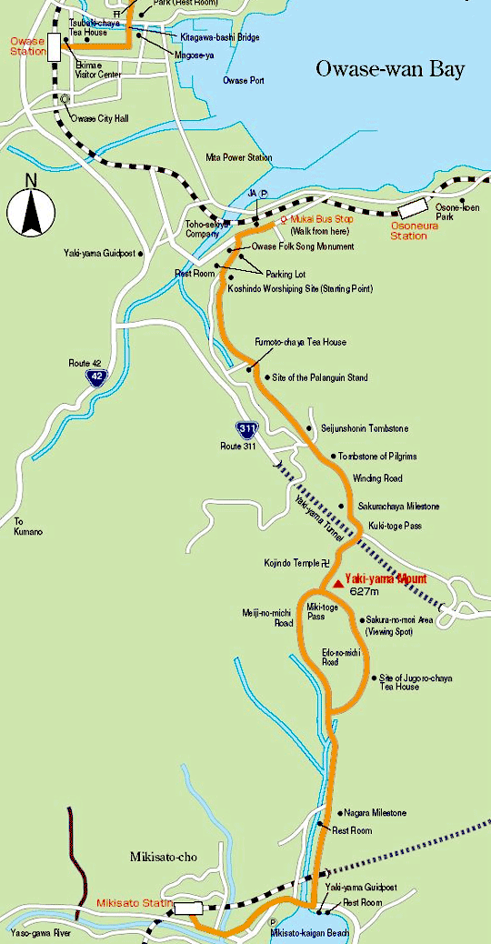
Mukai Bus Stop → 0.4 Km 10 mins. → Owase Folk Song Monument → 0.4 Km 10 mins →
Starting Point → 1 Km 30 mins. → Kago-tateba (Site of the Palanquin Stand) →
2 Km 60 mins. → Kuki-toge Pass → 0.8 Km 20 mins. →
Miki-toge Pass (Roundtrip to and from Sakura-no-mori Area 0.7 Km 15 mins.) →
1.8 Km 40 mins. → Junction of the Meiji-nomichi and Edo-no-michi Paths 0.8 Km 15 mins. →
Nagara Milestone → 2.1 Km 40 mins. → Mikisato Station
Perilous Pass
About 10 Km, 4 hrs. from Mukai bus stop to JR Mikisato Station
Trails
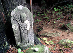 Pilgrims have called Yaki-yama (627 meters above sea level) the most perilous mountain in western Japan. Along with a steep trail and much precipitation, bandits and wolves once plagued the pilgrims. Jizo, a stone statue of the guardian deity of children (also a milestone) and tombstones of pilgrims are situated by the stone path. Crossing Miki-toge Pass and
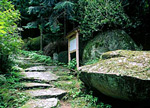 walking a little farther, you can find an open viewing spot covered with grass called the Sakura-no-mori Area. The spot commands a panoramic view of the Kumano-nada Sea and is the best place to rest for lunch. There are two paths, Edo-nomichi and Meiji-no-michi to descend to Mikisato.
Tsuzurato-toge Pass Route >>
Hadasu to Obuki-toge Pass Route >>
Nisaka-toge Pass Route >> Kannon-michi Path Route >>
Ikkoku-toge Pass to the Kumagaya-michi Path Route >>
Matsumoto-toge Pass to Hanano-iwaya Shrine Route >>
Hajikami-toge Pass Route >> Yokogaki-toge Pass Route >> Magose-toge Pass Route >> Fuden-toge Pass Route >> Crossing Yaki-yama Mount Route >>
Tori-toge Pass Route >> Miki-toge Pass to Hago-toge Pass Route >>
Kawabata(Kawatake)-kaido Road >> Sone-Jirozaka-Tarozaka Route
Hama-kaido Road Route(North) >> Nigishima-toge Pass to Okamizaka-toge Pass Route >>
Hama-kaido Road Route(South) >>