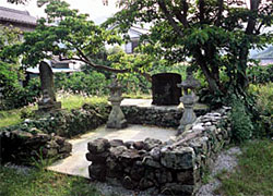
Atawa Station → 2.8 Km, 60 mins. → Tombstone of Rokubu → 1.3 Km 30 mins →
Bikishi-sama → 2.8 Km 60 minis → Ida Milestone → 2.5 Km 60 mins. Kayumori-sama →
2 Km 40 mins. → Narukawa-no-watashi Ferry → 1.2 Km 20 mins. →
Kumano-Hayatama-taisha Shrine → 1.8 Km 30 mini. → Shingu Station
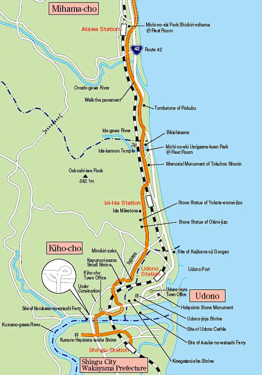
Shichiri-mihama Beach to the Kumano-gawa River via Terraces
About 14.4 Km, 5 hrs. from JR Atawa Station to JR Shingu Station
Trails
 Start the southward route of the Hama-kaido Road from JR Atawa Station when you come by train or from the rest station called“Michino-eki Park Shichiri-mihama” when you come by car. Walking from the old road through Route 42 leads to Shichiri-mihama Beach. There is a terrace with a fabulous lookout, if entering the hillside from Ida. Walking further down Mimikiri-zaka to the Kumanogawa River, there was once the Narukawa-no-watashi Ferry at the edge of the Kokudo-bashi Bridge.
 Kumano Hayatama-taisha Shrine is located in the forest on the right side of the bridge across the river. Another route from Ida stretches south along the coastline, passing Udono and crossing the Kumano-gawa River at Asuga-no-watashi Ferry under the JR Railway.
Tsuzurato-toge Pass Route >>
Hadasu to Obuki-toge Pass Route >>
Nisaka-toge Pass Route >> Kannon-michi Path Route >>
Ikkoku-toge Pass to the Kumagaya-michi Path Route >>
Matsumoto-toge Pass to Hanano-iwaya Shrine Route >>
Hajikami-toge Pass Route >> Yokogaki-toge Pass Route >> Magose-toge Pass Route >> Fuden-toge Pass Route >> Crossing Yaki-yama Mount Route >>
Tori-toge Pass Route >> Miki-toge Pass to Hago-toge Pass Route >>
Kawabata(Kawatake)-kaido Road >> Sone-Jirozaka-Tarozaka Route
Hama-kaido Road Route(North) >> Nigishima-toge Pass to Okamizaka-toge Pass Route >>
Hama-kaido Road Route(South) >>