We walk Kumano Kodo Street Iseji.

Way of good luck end

Iseji route introduction

There is "good luck" as much as we walked

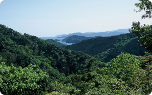
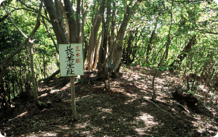
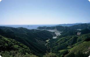
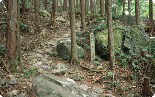
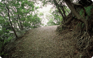
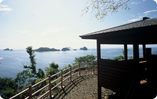
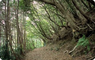
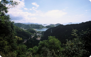
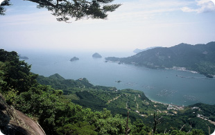
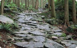
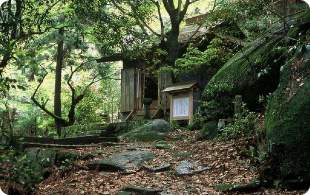
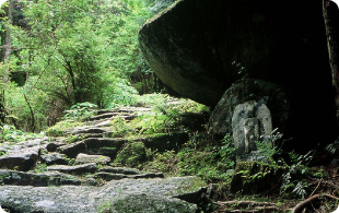
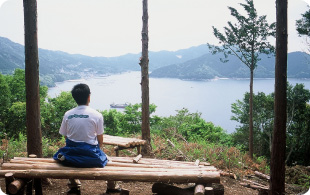
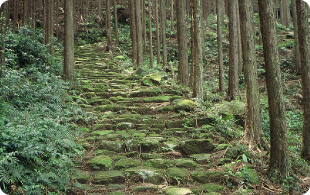
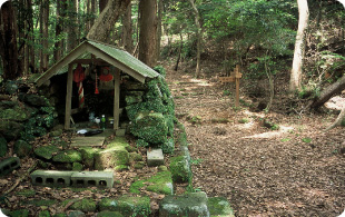
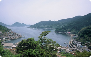
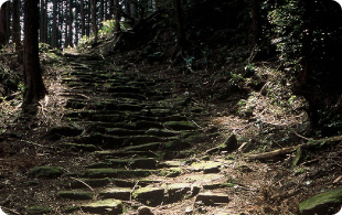
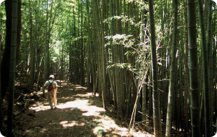
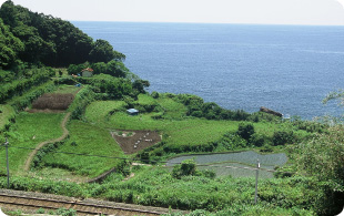
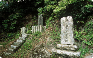
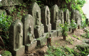
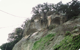
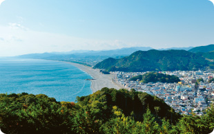
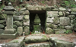
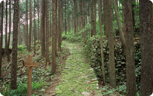
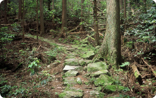
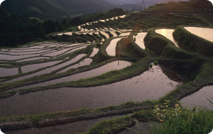
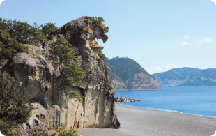
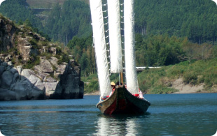
Superb view to overlook from monument, mountain pass ticking away beautiful stone pavement, history….
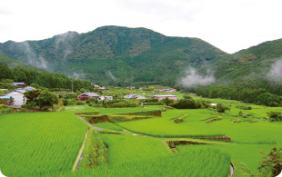
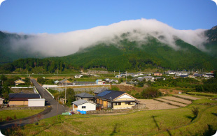
There is a lot of highlight in Kumano Kodo Street Iseji that was chosen for "100 selections of strolls".
We introduce Kumano Kodo Street Iseji walking the distance to leave ancient feature for exhaustively.

Kumano Kodo Street Iseji Route Walking Guide Map downloading (English version)

Kumano Kodo Iseji route Access Guide Map downloading

Full length
Approximately 170km

Annual
Approximately 320,000 walks

We express physical strength level for walk level / walk

  • Product for beginners
  • Product for public
  • Product for good walkers

It is distance and time from / starting point of a mountain climb nearest station (bus stop) to the Shimoyamaguchi nearest station (bus stop) at distance, walk time

When we click number
Iseji route information
You can confirm.

  • Nisaka-toge Pass
  • Tsuzurato-toge Pass
  • Ikkoku-toge Pass, Hirakata Pass, bear ka valley way
  • Hajikami-toge Pass
  • Magose-toge Pass
  • Yakiyama-goe
  • Miki-toge Pass - Hago-toge Pass
  • Sonejiro-zaka & Taro-zaka
  • Nigishima-toge Pass - Okamizaka-toge Pass
  • Hadasu Pass, Obuki-toge Pass
  • The Kannon Pass
  • Matsumoto-toge Pass
  • Yokogaki Pass
  • Fuden-toge Pass
  • Tori-toge Pass
  • The road along the beach
  • The Kumano River

Of Iseji
How to walk

maplink

Of Iseji
How to walk

nisakatouge Nisaka-toge Pass

Turn into Tsuzurato-toge Pass from the middle of Edo era; in official route of Kumano Highway. We see the good offing of view, and it is flat, and phrase board of Bokushi Suzuki is built.

  • Distance / approximately 7.5km (Taiki-cho - Kihoku-cho)
  • Walk time /2 time 30 minutes
  • Altitude /241m
  • Walk level /

The details are this

We close X

Bamboo clothes box and mountain pass Tsuzurato-toge Pass

We were used as life way until the early days of the Showa era even after Nisaka-toge Pass became official route after the Edo era. State of preservation of stone pavement, stone wall is good, too

  • Distance / approximately 9.5km (Taiki-cho - Kihoku-cho)
  • Walk time / approximately four hours
  • Altitude /357m
  • Walk level /

The details are this

We close X

ikkokutouge, hirakatatouge, kumagayamichi Ikkoku-toge Pass, Hirakata Pass, bear ka valley way

Gentle course that can enjoy scenery of Lake elegant Kumano floating Kojima. It is recommended to drop in at hot spring of hometown.

  • Distance / approximately 7.6km (Kihoku-cho)
  • Walk time / approximately three hours
  • Altitude /113m
  • Walk level /

The details are this

We close X

Is ashamed, and chew; mountain pass Hajikami-toge Pass

"hajikami" meaning salamander (we are ashamed and chew) is origin of the name of mountain pass.
We can overlook islands called Matsushima of Kii from observation deck of mountain pass.

  • Distance / approximately 3.5km (Kihoku-cho)
  • Walk time / approximately one hour 50 minutes
  • Altitude /147m
  • Walk level /

The details are this

We close X

magosetouge Magose-toge Pass

Stone pavement where solid native rock was spread all over in a heap protected ancient morality from rain of Owase that was proud of top-class precipitation in Japan.

  • Distance / approximately 5.2km (Kihoku-cho - Owase-shi)
  • Walk time / approximately two hours 45 minutes
  • Altitude /325m
  • Walk level /

The details are this

We close X

We get fried mountain Yakiyama-goe

We were said to be thirty-three holy places for pilgrimage in the Kinki district's best difficult place, and we appeared frequently, and bandit and wolf were ever afraid of by pilgrim, too. Much Ishibotoke nestles besides stone pavement way.

  • Distance / approximately 10.1km (Owase-shi)
  • Walk time / approximately five hours
  • Altitude /647m
  • Walk level /

The details are this

We close X

Miki Pass, hagotouge Miki-toge Pass - Hago-toge Pass

In late years we were found by local people. Good way of view from between trees with an ocean view. Inokake meandering from mountain pass is said to be the longest in our district.

  • Distance / approximately 6km (Owase-shi)
  • Walk time / approximately three hours
  • Altitude /140m
  • Walk level /

The details are this

We close X

sonejirouzaka, tarouzaka Sonejiro-zaka & Taro-zaka

It is drawn a boundary with Owase-shi and Kumano-shi at boundary, the present of country of Shima and country of Kii around the Middle Ages. We can come across others around historic spot of Sone, beautiful stone pavement and Inokake.

  • Distance / approximately 5.7km (Owase-shi - Kumano-shi)
  • Walk time / approximately three hours
  • Altitude /305m
  • Walk level /

The details are this

We close X

nigishimatouge, okamizakatouge Nigishima-toge Pass - Okamizaka-toge Pass

Meaning that God of Ise and Kumano meets "aishin." When wolf appeared frequently once. Mossed stone pavement almost leads to all sections.

  • Distance / approximately 4.6km (Kumano-shi)
  • Walk time / approximately three hours
  • Altitude /290m
  • Walk level /

The details are this

We close X

hadasunomichi, obukitouge Hadasu Pass, Obuki-toge Pass

Legend and mythical village where jofukudensetsu is left in Hadasu. Visiting historic spots, let's feel eternal time. Rare Takebayashi opens in Obuki-toge Pass in Kumano Kodo Street.

  • Distance / approximately 8km (Kumano-shi)
  • Walk time / approximately three hours
  • Altitude /205m
  • Walk level /

Hadasu Pass is this Obuki-toge Pass way is this place

We close X

kannommichi The Kannon Pass

The Kannon Pass which Kannon stone statue of the pilgrimage around the thirty-three holy places in the Kinki district thirty-three temples compared with besides way was used well without passing Obuki-toge Pass in the times when Kannon worship was prosperous.

  • Distance / approximately 3.8km (Kumano-shi)
  • Walk time / approximately one hour 40 minutes
  • Altitude /265m
  • Walk level /

The details are this

We close X

Hananoiwaya from the ancient times
Power spot.

Rock of Matsumoto Pass, flower Matsumoto-toge Pass, Hananoiwaya

Beautiful stone pavement remains, and, at mountain pass among Takebayashi, guardian deity of children like size of life meets.

  • Distance / approximately 4.1km (Kumano-shi)
  • Walk time / approximately one hour 45 minutes
  • Altitude /135m
  • Walk level /

Matsumoto gap is this place Kumano city is this place

We close X

As of July, 2015,
There is suspended point by collapse partly.

The side comes; mountain pass Yokogaki Pass

Stone pavement where sacred tree rhyolite peculiar to this ground was spread all over spreads out orderly.
Gentle Tanada opens to village, Sakamoto of the foot.

  • Distance / approximately 5.4km (Mihama-cho)
  • Walk time / approximately two hours ten minutes
  • Altitude /305m
  • Walk level /

The details are this

We close X

Phew mountain pass which does not appear Fuden-toge Pass

Mountain pass which was high office to link mountain village to the seaside. Mossed stone pavement spreads out, and huge morning fog "wind biography Oroshi" is seen at the foot from autumn to spring.

  • Distance / approximately 4.1km (Kumano-shi, Mihama-cho)
  • Walk time / approximately one hour 30 minutes
  • Altitude /257m
  • Walk level /

The details are this

We close X

Street mountain pass Tori-toge Pass (1000, Maruyama Hirata)

Way where we were used for a long time as life way, and blessing of the sea and riches of the soil came and went. From observation deck, we can overlook mountain range with wonderful Tanada built on the hillside.

  • Distance / approximately 7.9km (Kumano-shi)
  • Walk time / approximately two hours 20 minutes
  • Altitude /390m
  • Walk level /

The details are this

We close X

hamakaido The road along the beach

Way toward Shingu where kumayasokugyokudaisha is enshrined along seven village Mihama from Kumano city. * of the sea and contrast of white wave are splendid.

  • Distance / approximately 26.6km (Kumano-shi, Mihama-cho, Kiho-cho)
  • Walk time / approximately nine hours
  • Walk level /

The road along the beach(the north) is this The road along the beach(the south) is this

We close X

kumanogawa The Kumano River

We experience the Kumano River with three sail and can realize the Kumano River while looking at Bhikkuni fall and molding thing of mysterious nature including bell stone. Along the Kumano River, there is Kawabata (river length) highway (as of ※ July, 2015, impossible of traffic).

We close X